Off the Map and Under the Falls: America's Secret Water Routes That Guides Refuse to Publish
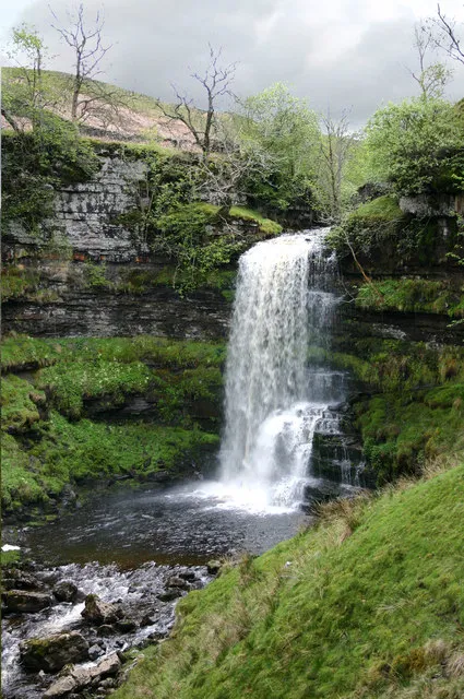
Photo: Andrew Mawby, CC BY-SA 2.0, via Wikimedia Commons
There's a waterfall in a remote valley in the American Southwest that drops nearly two hundred feet into a pool so clear you can see the bottom from the rim. It doesn't have a name on any official map. It doesn't appear in any guidebook. The handful of professional guides who know how to reach it have made an informal agreement not to publish coordinates, not to post it on social media, and not to take groups there without a serious conversation about why discretion matters.
We're not going to tell you where it is either. But we are going to tell you why that matters — and what it means for anyone who wants to find places like it.
The Geography of Invisibility
America's most visited natural landmarks are suffering. The numbers are hard to argue with: Havasu Falls in Arizona now requires a lottery system just to access. The slot canyons of southern Utah have waiting lists and mandatory guided tours. Angels Landing sees millions of visitors annually, and the erosion and crowding have fundamentally changed the experience of being there.
But for every famous waterfall drowning in Instagram content, there are dozens of equally stunning features that remain effectively invisible to the broader tourism ecosystem. They sit in the drainage systems of remote valleys, tucked into canyon forks that don't appear on popular hiking apps, accessible only through routes that require technical skills or local knowledge that most visitors simply don't have.
This invisibility isn't accidental. In many cases, it's actively maintained.
"There are places I've been guiding people for fifteen years that I've never once posted about," says a professional canyon guide in the Four Corners region who asked to remain anonymous. "The moment you put a GPS pin on something, you've changed it. You can't un-ring that bell."
Why Rangers Go Off-Script
Park rangers occupy a complicated position in this conversation. Their official mandate is to facilitate public access to public lands. But many rangers who've watched popular sites transform under the weight of viral tourism have developed a more nuanced view of what "facilitating access" actually means.
"I'll answer any question someone asks me directly," says one ranger at a national forest in the Pacific Northwest who declined to be identified by name. "But I'm not going to volunteer information about sensitive sites to someone who's just going to post it and move on. I've seen what happens."
What happens, in practical terms: a site that once saw a dozen visitors a year starts seeing hundreds. Informal trails get worn into erosion channels. Delicate riparian vegetation gets trampled. Fire rings appear. Graffiti follows. The feedback loop between social media visibility and site degradation is now well-documented enough that land management agencies have started studying it formally.
The hidden waterfall chains and unmarked slot canyons that remain intact today are, in many cases, intact precisely because they've stayed out of that loop.
The Technical Barrier as Accidental Protector
Some of America's most spectacular water features are protected not by policy but by difficulty. Technical canyoneering routes that require rappelling, swimming, and route-finding through unmarked terrain naturally filter out casual visitors. The same is true of certain river corridors that demand whitewater skills, and of waterfall approaches that involve off-trail navigation through dense wilderness.
This technical barrier has functioned, more or less accidentally, as a conservation mechanism. The people who reach these places have generally made a significant investment in skill and preparation. They tend to understand leave-no-trace principles not as a slogan but as a practical philosophy. They've earned the experience in a way that correlates, imperfectly but meaningfully, with a willingness to protect it.
Climber and wilderness guide Priya Nambiar, who has spent years exploring remote valley drainage systems in the Sierra Nevada, puts it bluntly: "The places I care most about are the ones that were hard to get to. That's not elitism — it's just reality. Difficulty creates a kind of natural stewardship."
An Ethical Framework for the Curious
None of this means that adventurers should stop looking for hidden places. Curiosity is the engine of genuine exploration, and there's something important about the human impulse to go beyond the marked trail. But the way you look matters enormously.
A few principles that experienced guides and rangers consistently emphasize:
Earn the knowledge locally. The best information about hidden water routes almost always comes from people with deep ties to a place — local outfitters, longtime residents, regional hiking clubs, tribal land managers. Building those relationships takes time and genuine engagement. It also tends to come with context that GPS coordinates alone never provide.
Don't publish what you find. The agreement among guides who know sensitive sites is simple: keep it verbal. Share information with people you trust and who've demonstrated they'll treat places with care. Don't post coordinates, don't geotag photos, don't write detailed route descriptions for public consumption.
Read the land before you read the reviews. Apps and forums can tell you what a place looks like. They can't tell you about seasonal access, fragile ecosystems, or the cultural significance a site may hold for Indigenous communities. Do that homework separately, through sources that require more effort.
Accept that some places should stay hidden from you. This is the hardest one. Not every spectacular place is meant for every visitor. Some canyon systems on tribal lands are genuinely off-limits, and the reasons for that go deeper than any adventure itinerary. Some sites are so ecologically sensitive that even careful visitors cause cumulative harm. Knowing when to walk away — or to never approach in the first place — is part of what separates ethical explorers from tourists with good gear.
The Reward of Restraint
There's a certain irony in the fact that the most meaningful discoveries tend to come to people who aren't aggressively pursuing them. The guides and rangers we spoke with described the same pattern repeatedly: adventurers who came to a region with genuine humility, who asked questions carefully and listened more than they talked, who demonstrated over time that they understood the stakes — those are the people who eventually got pointed toward the places that don't appear on any map.
The hidden waterfall in the Southwest, the unmarked canyon corridor in the Rockies, the waterfall chain that a local historian has been quietly protecting for thirty years — these places exist. They're out there, in the drainage folds of valleys that most people drive past without stopping.
Finding them isn't about having the right app. It's about being the kind of traveler who deserves to find them.
That's a longer road. But it's the one worth taking.